1 怎样获得osm上的行政区划shp文件(综述)
https://www.jianshu.com/p/03a9204e2380
https://zhuanlan.zhihu.com/p/74047925
2 选择市区,下载json
http://datav.aliyun.com/tools/atlas/#&lat=33.521903996156105&lng=104.29849999999999&zoom=4
3 可以批量导入json,转化为shp,注意名字是乱码需要重新关联,参考链接1的说明
https://mapshaper.org/
4 osm-导出边界
https://wambachers-osm.website/boundaries/
其它:
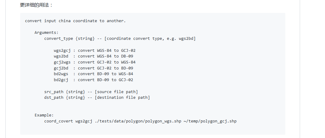
面的坐标系转换
https://github.com/sshuair/coord-convert

https://files-cdn.cnblogs.com/files/hdu-2010/coord-convert-master.zip
https://files-cdn.cnblogs.com/files/hdu-2010/ArcBruTile_1.0.2.zip
-----
搜索ID
https://www.openstreetmap.org/relation/10724589
下载轮廓
http://polygons.openstreetmap.fr/index.py
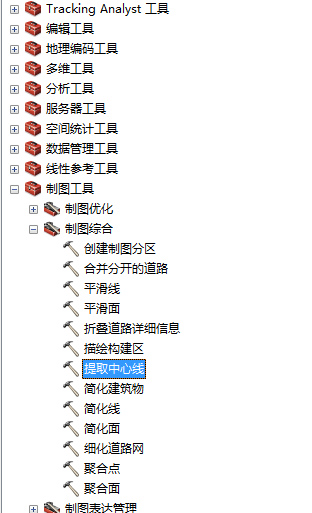
获取道路中心线

https://jingyan.baidu.com/article/ad310e80ef7ec81849f49ec4.html
https://desktop.arcgis.com/zh-cn/arcmap/10.3/tools/cartography-toolbox/collapse-road-detail.htm
下面将向您展示如何使用mapshaper.org简化地图,减小文件大小并由此针对Web对其进行优化。在诸如StatPlanet的地图或仪表板应用程序中,简化地图可以极大地加快加载时间。
Mapshaper接受几种地图格式,即:shapefile,GeoJSON和TopoJSON。在本教程中,shapefile贴图被简化,但是其他贴图格式的过程相似。
https://www.statsilk.com/maps/simplify-map-reducing-file-size-and-loading-time
//简化面或者线文件

This tutorial shows you how to simplify a map using mapshaper.org, to reduce the file size and thereby optimize it for the web. In mapping or dashboard applications such as StatPlanet,
simplifying a map can greatly speed up the loading time.
Mapshaper accepts several map formats, namely: shapefile, GeoJSON and TopoJSON. In this tutorial a shapefile map is simplified, but the procedure is similar for other map formats.

case1
https://mapshaper.org/

case2
https://desktop.arcgis.com/zh-cn/arcmap/latest/tools/cartography-toolbox/simplify-polygon.htm
#1 Compare two or more shapefiles and return the differences
If you have access to an ArcGIS Advanced License (ArcInfo) you could run the Erase (Analysis) tool, which will produce the difference.
ArcGIS Help (10.2, 10.2.1, and 10.2.2)
https://community.esri.com/thread/164348
http://resources.arcgis.com/zh-cn/HELP/MAIN/10.2/index.html#//00080000000m000000